Kemet and Deshret — Black Land / Red Land
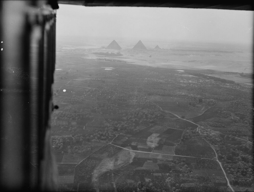
GEOMYTHA reads the cultivated land and desert edge as a material example of a field becoming differentiated by a boundary. Fertility depends on conditions that extend beyond the field itself; the border makes a distinction visible without making either side metaphysically absolute. In this limited comparison, the cultivated ground can invite an Isis/IS reading of what supports appearance, and the edge a Set/I reading of definition or separation. These are questions posed to the landscape, not dictionary meanings of Kemet and Deshret. Calling the desert merely evil or empty would make the interpretation less attentive to the place it is meant to illuminate.
The conventional reading describes environmental vocabulary and cultivated land beside desert. The GEOMYTHA reading compares support and boundary with field and claim. It does not translate Black Land as Isis or Red Land as Set.
Ancient Egyptian geography, Nile agriculture and royal/religious traditions
UCL, Colour in Language, km/dSr and fertile soil/desert opposition; Harvard Digital Giza FAQ; Ranke (1950), geography only; LOC matpc.15918.
The Isis/Set mapping is editorial, not an established lexical equivalence. No racial category, universal moral color code or permanent good/evil geography is derived from black and red. Ranke's 1950 article is cited only for geography; its obsolete racial classifications are not accepted or used.
Claim tested: the cultivated-land/desert edge can clarify a field/boundary relation. Support: visible contrast in the archival photograph. Counterexample: a boundary is a relation, not proof that one side is spiritually superior; cultivation also depends on water and human work. Category test: fertile/desert does not equal Upper/Lower Egypt, and Deshret the landscape must not be treated as identical to every use of Red Crown vocabulary. Result: retain a local environmental comparison; reject a universal Isis/Set map.
Original story and earliest witnesses: these are geographic and linguistic categories rather than one original myth. This review consults UCL's attested vocabulary and contextual oppositions, corroborated by Harvard Digital Giza; it does not establish the earliest inscription of either place term. Ranke (1950) is retained as historical geographic bibliography with its limitations noted. The Matson image dates to 1932 and shows the cultivation/desert boundary near the pyramids. It is later visual evidence, not a photograph of ancient conditions.
